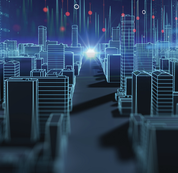
A bottleneck is starting to form in a particularly busy intersection in your city. Thanks to the sensors installed in cars (which increasingly are becoming connected cars), the on-board navigator will suggest alternative routes to avoid time lost in a traffic jam. In the meantime, the municipal traffic management centre has already noticed the situation on the digital map of the city and can dispatch traffic officers quickly to the site.
At the same time, sensors mounted on rubbish bins are communicating with waste collectors to indicate when they need to be emptied, thus avoiding unnecessary collection rounds and optimising the work. Leaks from aqueducts have also been drastically reduced thanks to a network of sensors that monitor the situation and provide immediate notification when repairs are needed. But in the smart cities of the future, which is now at our door, big data provided by private citizens will play an essential role.
For example, we will all have apps to transmit information on problems encountered in daily life (such as potholes). This will enable the authorities to have the overall situation under constant control and schedule activities and works to be carried out under the best conditions. Furthermore, during large demonstrations and events the authorities will be able to control the flow of people moving towards a single place, thus mitigating the risk that excessive crowding produces a potentially dangerous situation.
Cities are not the only areas where big data can be used in the future: even now the town of Terracina uses technology supplied by TIM to fight fires. Through this solution to detect forest fires it is possible to keep a vast territory under control 24 hours a day, analysing extremely high-definition images taken by a video camera able to reconstruct a 360-degree view of a surface covering several kilometres.
The same software can also be used to detect thermal variations that are signs of small fires. In case of an alarm it is possible to alert the emergency squads who can study the video camera images to inspect all the details in the zone in question. The operators are assisted by an immense set of data visible on a map that indicates various points of interest (water supply reservoirs, firefighting equipment and squads, hotspots, and so on), making it possible to intervene with the utmost efficiency.
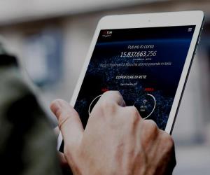
What is the common denominator in all these technological solutions that promise to make the city (and beyond) ever safer and more habitable? Geolocation. All this is only possible because information obtained from sensors – part of the Internet of Things network, which by 2025 will connect 75 billion devices to the internet – provides data, in real time, relating to the position of cars, video cameras, waste containers and people as well. Georeferenced information, however, can be applied in other areas not related to safety. Today's tourists, for example, can use an application, as soon as they arrive in a city, to indicate their interests and receive information on museums, monuments, events, restaurants and much more, based on their present location.
Nothing futuristic about it: thanks to applications like Spotted, Like a Local or the one designed by Lonely Planet, we can already visit a city and experience it as the locals do, far from the madding crowd of congested tourist attractions. Similar services are also available on the institutional applications developed by large cities, like Visit Milano, or on the websites of smaller places. One example, for instance, is GeoSabina, the site promoting tourism and culture in the Sabina region in Lazio. Here an interactive map displays information on the main cultural points of interest in the area.
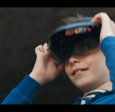
In the future, the potential for these tools will improve drastically thanks to augmented reality, the technology whereby digital information is overlaid on the real world. With the help of a smartphone or smart glasses, users can obtain information on a city's attractions in ways that are simpler, more intuitive and more immediate. There are nevertheless some obstacles to overcome: for example, how can people's privacy be protected when all their movements are traced? This issue is already of fundamental importance but in the future it will become absolutely crucial. All things considered, however, one thing is certain: thanks to sensors, big data and georeferenced information we will be able to hold the whole city in our hands.